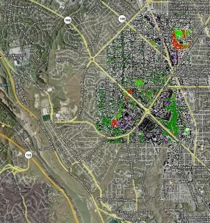
Click on image for larger view.
Fort Reno is in the upper right hand corner. According to the USGS, this test did not directly measure the levels of arsenic in the dirt but rather how the grass growing in that dirt reacted to it. The red areas represents “arsenic-affected grass” and the brighter green is normal grass. The darker green regions are trees.
Bottom line - stop eating the dirt. And move your birthday party to the suburbs.


1 comment:
Very helpful, which the grainy version on local tv news was not.
Post a Comment